Semmering Railway
Reading time: 13 minutes
SEMMERING RAILWAY, LOWER AUSTRIA AND STYRIA, AUSTRIA
Where Stone Viaducts Carry Trains Through the Alps
High above the wide southern approaches to Vienna, where the limestone ridges of the Wiener Alpen begin to rise steeply toward the Semmering Pass, runs one of the most remarkable feats of nineteenth-century European engineering. The Semmering Railway, built between 1848 and 1854, was the first standard-gauge mountain railway in Europe and is widely regarded as the moment when modern rail crossed its first great natural barrier. Long curving viaducts of pale stone leap across deep ravines, tunnels disappear into forested hillsides, and trains still wind through the same alignment laid out by a single visionary engineer more than 170 years ago.
The line stretches 41 kilometres between Gloggnitz in Lower Austria and Mürzzuschlag in Styria, passing 15 tunnels, 16 viaducts, and around 100 smaller stone bridges, and rising some 500 metres in altitude over the Semmering Pass. Since 1998 the entire route has been a UNESCO World Heritage Site, recognised not only for its technical achievement but for the unusual harmony with which it sits in the surrounding mountain landscape. The arrival of the railway also transformed this corner of the Alps from wilderness into a summer-resort paradise for the imperial court and the Viennese upper classes, and many of the grand hotels, villas, and lookout platforms from that era still survive along the route.
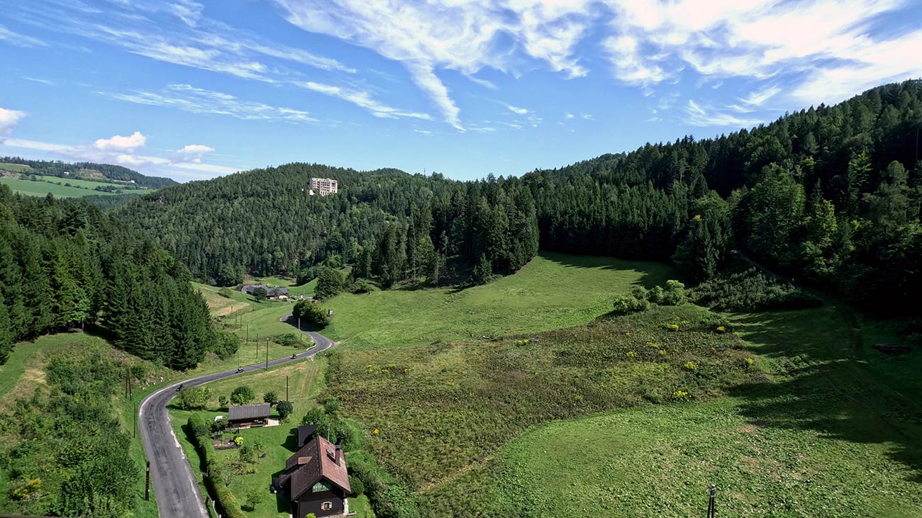
For cyclists exploring the these stretches of the EuroVelo 6 along the Danube, the Semmering Railway makes for a memorable cultural detour from Vienna, the natural transfer point on the river. A direct rail journey of around one hour brings you to Payerbach-Reichenau at the foot of the climb, where most visitors switch to walking or to the historic train itself for the dramatic ascent over the pass. The combination of train, viaducts, viewpoints, and forest paths makes the area equally rewarding for half-day excursions and for longer stays with hiking and viewing platforms scattered along the line.
UNESCOTrainScenic RideHiking
Europe’s First Mountain Railway and the Walk to the 20-Schilling View
The Semmering Railway is the work of the Austrian engineer Carl Ritter von Ghega (1802–1860), a former mathematics professor whose proposal to build a standard-gauge railway across the Alps was at first dismissed as impossible. Returning from a study trip to the United States in 1844 with his full plans already drawn, Ghega faced strong opposition from the engineering establishment of his day but pressed on regardless. He limited the maximum gradient to 28 per mille, linked opposing mountain slopes with viaducts and bridges, and roughly doubled the straight-line distance of the route in order to follow the natural contours of the terrain. Around 20,000 workers built the line in just six years, using techniques that today would be considered remarkably primitive, since dynamite was not invented until twelve years after the work began. The result is a railway that still carries up to 200 trains a day along its original alignment, more than 170 years after it was completed.
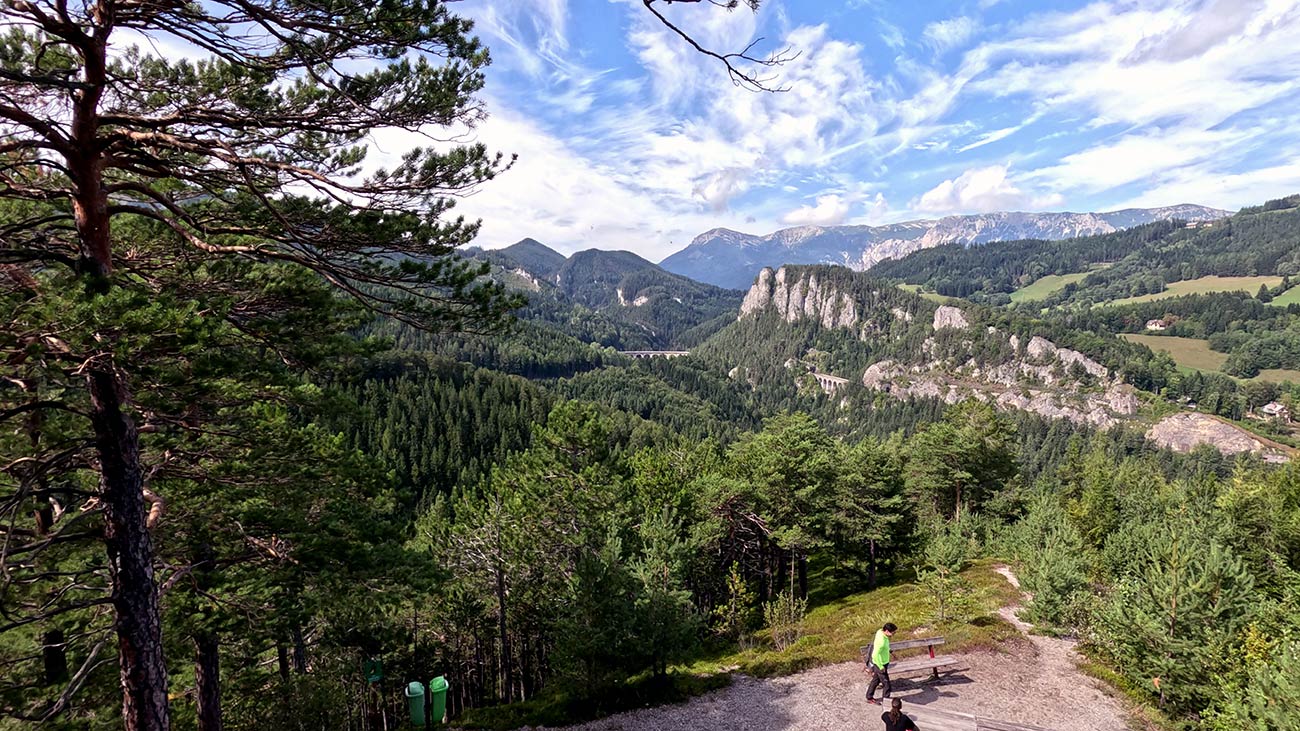
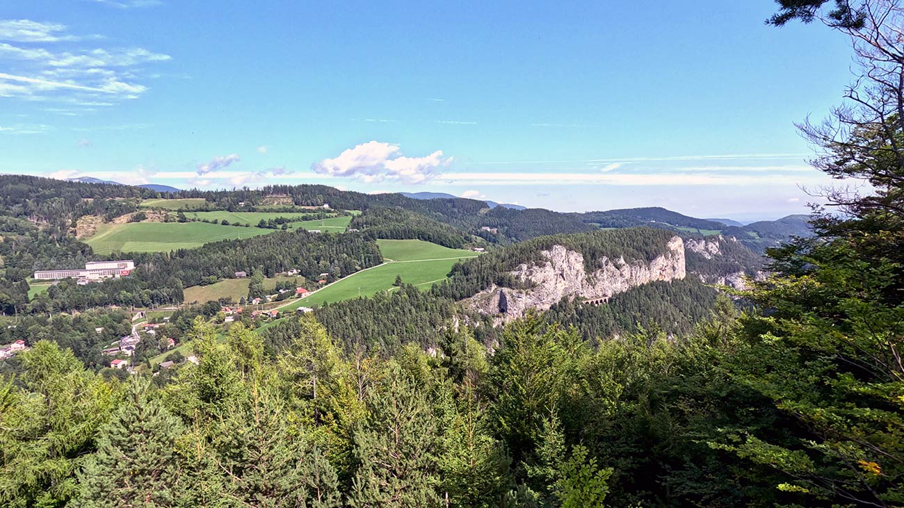
The most celebrated of the structures along the line is the Kalte Rinne Viaduct (Viadukt über die Kalte Rinne), a two-tier stone arched bridge that strides across a deep ravine on the northern side of the Semmering Pass. Its arches, set in two superimposed rows, have become the visual symbol of the entire railway. A second remarkable structure is the Krausel-Klause Viaduct, also built in two tiers and set in a steep wooded valley a short distance further along the line, with a similarly dramatic effect. Both viaducts can be admired from several lookout platforms above the railway, and the train itself crosses each of them on the way over the pass, slowing slightly so that passengers can take in the engineering and the view at the same time.
The classic walk for visitors is the route to the 20-Schilling View (20-Schilling-Blick), a lookout platform above the Semmering Pass that gives a frontal view of the Kalte Rinne Viaduct from across the ravine. The name comes from the old Austrian 20-Schilling banknote, in circulation between 1986 and 2002, which carried a depiction of this exact viaduct alongside a portrait of Carl Ritter von Ghega. Standing at the lookout today, the resemblance to the banknote image is immediate. The hike is part of the longer Railway Hiking Path (Bahnwanderweg), which follows the line between Semmering at the top of the pass and Payerbach-Reichenau at its foot, with the 20-Schilling View near its midpoint. The full path runs around 20 kilometres and takes a long day, but most visitors do only a section of it. Several other lookout platforms along the route, including the Weinzettlwand and the Doppelreiter Lookout Tower on the Wolfsbergkogel, offer additional views over the railway, the villas of the Semmering plateau, and the surrounding peaks of the Rax and the Schneeberg.
For travellers who would like to combine the visit with cycling, the regional tourism board has signposted a World Heritage Cycle Route that loops 37 kilometres from Gloggnitz through Schottwien and Maria Schutz to Semmering and back through the Adlitzgräben valley, with roughly 600 metres of elevation gain. The route is officially classified as difficult and is recommended only for sporty cyclists rather than as a casual outing. For most visitors arriving with a touring bike from the EuroVelo 6 along the Danube, the railway and the hiking paths offer the more relaxed and rewarding experience, and the two main stations of Payerbach-Reichenau at the lower end and Semmering at the top of the pass are the natural places to park the bike for a day on foot.
 Useful Links
Mobility for Cyclists
Reaching the area by train with your bike
The Semmering Railway can be reached from the EuroVelo 6 by a direct rail journey from one of the main cities on the Danube cycle path. The area lies around 80 kilometres south of the Danube in the eastern foothills of the Alps, and the connection to the river corridor passes through the Austrian capital itself, which is the natural transfer point.
The connection
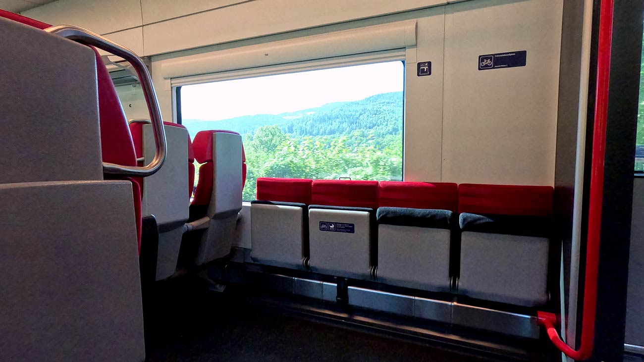
The most practical connection from the EuroVelo 6 corridor is from Vienna, where ÖBB regional and intercity trains run directly to the stations along the historic line. Payerbach-Reichenau, at the foot of the climb on the northern side of the Semmering Pass, is reached in around one hour from Vienna Hauptbahnhof. Semmering, at the top of the pass, is reached in around 1 hour 25 minutes on the same line. Both stations are served frequently throughout the day, and travelling on the historic alignment itself is part of the experience, as the train passes over the great viaducts and through the original tunnels built by Ghega’s workers in the 1850s. Slower regional services give the best views, and the heritage character of the line is at its strongest on the section between Payerbach-Reichenau and Semmering.
Austrian trains
The rail network in Austria is operated mainly by ÖBB (Österreichische Bundesbahnen), the Austrian Federal Railways, which runs most long-distance services and a large share of regional connections across the country. Alongside ÖBB, the private operator Westbahn provides competing long-distance services on the main east-west corridor between Vienna, Salzburg, and onward to Munich. Several smaller regional operators run local and feeder lines on secondary routes, but they are fully integrated into the national rail system, so transfers between operators are straightforward. The Danube region in Austria is particularly well served by rail: the main east-west line links Vienna with Krems, Linz, Wels, Salzburg, and the German border at Passau, closely paralleling the river for much of its length and forming one of the busiest and most reliable rail axes in central Europe. From the main cities along this corridor, dense networks of regional and S-Bahn lines branch out both north and south of the Danube, with frequent departures throughout the day that make inland detours easy to organise without long waiting times or complicated changes. The ÖBB app is the central tool for planning journeys, checking timetables, and purchasing tickets across all services, including both regional and long-distance trains.
Taking your bike
Austria is generally very bike-friendly when it comes to rail transport, especially on regional services operated by ÖBB, which form the core of mobility for cycle touring along the Danube and its connecting corridors. On regional and S-Bahn trains, bicycles can be taken on board for an additional fee, with no advance reservation possible and a first-come, first-served allocation of space. Bicycle tickets are sold as single trips or as affordable daily, weekly, or monthly passes, and the Klimaticket Austria annual pass includes free bicycle transport on regional trains in several federal states. On long-distance services such as Railjet, Intercity, Eurocity, and Nightjet trains, an advance reservation for the bicycle is mandatory, with the bike zones located in second-class carriages. The private operator Westbahn, which runs frequent services along the main east-west corridor between Vienna, Linz, and Salzburg, also accepts bicycles, but only with an advance reservation. Folding bikes are carried free of charge as hand luggage on both ÖBB and Westbahn trains. Overall, the Austrian system is well adapted to cycle tourism and offers a flexible combination of train and bike that makes it easy to leave the EuroVelo 6 route in either direction for short or extended detours.
Bikes on Buses
Long-distance bus services in Austria are primarily operated by FlixBus and by ÖBB-Postbus, the long-distance coach arm of the Austrian Federal Railways, complemented by a smaller number of regional and private coach operators on selected routes. The long-distance bus market in Austria is less developed than in neighbouring countries, as the wider rail network covers most of the country efficiently and many connections that would otherwise be served by intercity coaches are instead handled by train. Bicycle transport is available on certain FlixBus connections, either via external bike racks or in the luggage compartment, but it is not consistently guaranteed across the network and depends on the specific vehicle type and route configuration. Where available, bicycle transport must be reserved in advance and capacity is limited, making it less flexible compared to rail services. ÖBB-Postbus also operates seasonal bicycle and hiking buses in cooperation with regional tourism boards, designed specifically to bring cyclists and hikers to popular starting points along trails and bike paths, although these services run on selected routes only and outside the main long-distance network. As a result, buses are generally used as a secondary option for cyclists, mainly for longer-distance repositioning between major cities rather than as a core part of cycling itineraries along the Danube region. While useful in specific cases where rail connections are less convenient, they are less predictable and less standardised for bicycle transport, so advance planning is essential.
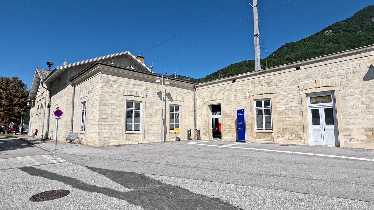
Arriving at Payerbach-Reichenau
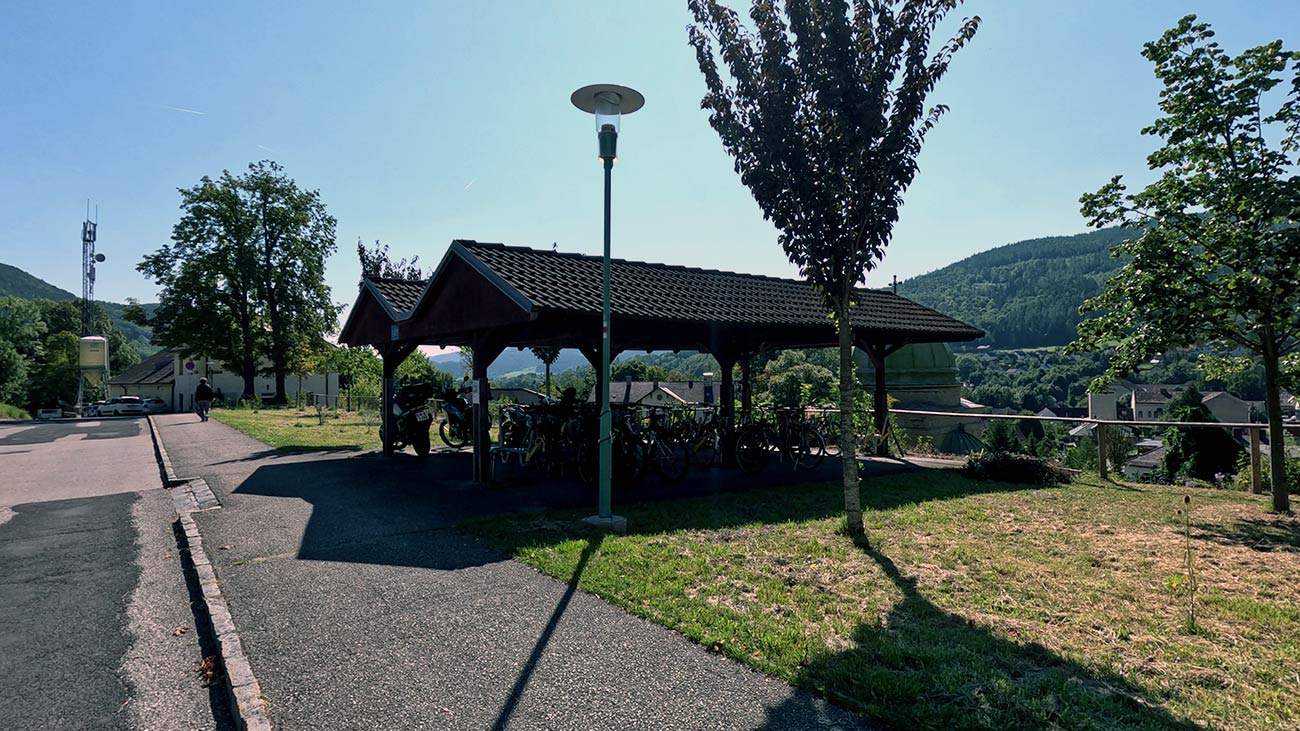
Both Payerbach-Reichenau (lower) and Semmering (upper) are practical bases for exploring the railway on foot. Bikes can be left at the bike racks at either station for the day, since the Railway Hiking Path, the viewpoints, and the lookouts above the line are best reached by walking and are not suitable for cycling. From Payerbach-Reichenau the path climbs steadily through forest toward the 20-Schilling View and the Kalte Rinne Viaduct, while from Semmering the same route descends past several lookout platforms toward the lower station. Local maps and signposting are excellent throughout. For travellers riding the World Heritage Cycle Route, Gloggnitz is the official starting point of the loop, and its station also offers bike parking for shorter stops. For onward travel, the same ÖBB line connects back toward Vienna and the wider Danube corridor, so the Semmering Railway works equally well as a one-day excursion or as a longer overnight detour from the EuroVelo 6.