Steyr
Reading time: 15 minutes
STEYR, UPPER AUSTRIA, AUSTRIA
Where Two Rivers Meet in a Thousand-Year-Old Iron Town
In the gentle foothills south of Linz, where the limestone country of Upper Austria begins to climb toward the high Alpine ridges of the Kalkalpen National Park, lies a small city built around one of the most picturesque river confluences in central Europe. The Steyr and the Enns meet here in a clear Y-shape, joined by stone bridges and footpaths, with a Baroque castle rising on the wedge of land between them and a thousand-year-old town spilling down the slopes on either side. The result is a place that feels both quietly monumental and entirely walkable, the kind of Austrian town that travellers tend to discover almost by accident and remember for far longer than its modest scale would suggest.
Steyr was founded around the late tenth century as a fortified settlement at this strategic river meeting, when the Otakars, margraves and later dukes of Styria, built their castle of Stirapurhc on the high terrace above the confluence. The name of the castle later gave its name to an entire Austrian province, while the town that grew up below it became one of the great medieval iron-working centres of Europe. Wealth from that trade is still legible today in the long diamond-shaped town square, the painted facades of merchant houses, and the way each generation has left its style on the old town without ever quite erasing the one before, from late Gothic merchant mansions to Rococo town houses standing harmoniously side by side.
For cyclists exploring the Danube along the EuroVelo 6, Steyr makes for a straightforward and worthwhile cultural detour from the Austrian stretch of the route. The town lies around 30 kilometres south of Linz, the natural transfer point on the river, and is reached by a direct rail journey of around 40 minutes through the open countryside of Upper Austria. A day spent moving between the long arcaded square, the painted river houses, the Baroque castle on its terrace, and the Jesuit church beside the bridge offers a complete change of pace from the open horizontal of the Danube, and a genuine taste of Austrian small-city life.
CastleConfluenceOld TownMarket
The Y-Shaped Confluence of the Steyr and Enns
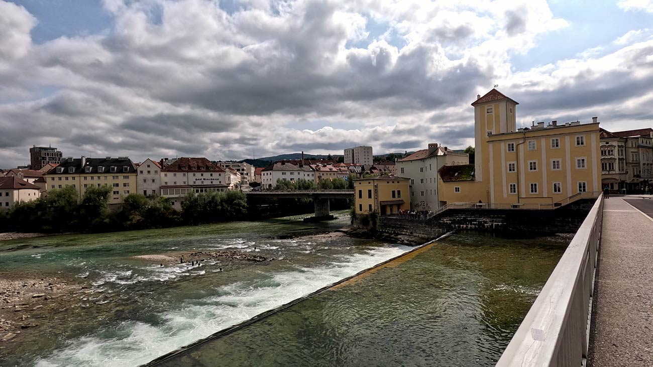
The natural anchor of any visit is the place where the Steyr River meets the Enns, two clear alpine rivers that join at a sharp angle right beside the old town. The smaller Steyr drops into the broader Enns over a low cascading weir, and the steady murmur of the water gives the whole centre of town a riverside soundtrack that follows you wherever you walk. A series of footbridges and walkways cross both rivers, and a short stroll along their banks reveals one viewpoint after another, from the painted houses of the lower town reflected in still pools to the steep bluff carrying Lamberg Castle high above the meeting point. For many travellers, the confluence is the single most photographed feature of Steyr and one of the loveliest urban river settings anywhere in Austria.
The Town Square and Its Painted Mansions
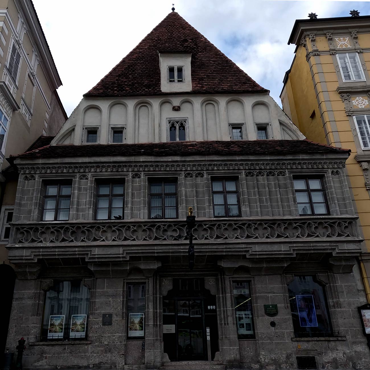
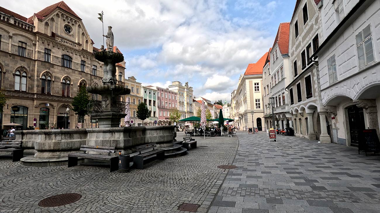
At the heart of the old town stretches the Town Square (Stadtplatz), a long diamond-shaped space framed by some of the finest historic town houses in Upper Austria. Almost every architectural era of central Europe is represented here, with late-Gothic merchant mansions, Renaissance facades, Baroque additions, and Rococo reworkings standing harmoniously side by side along arcaded ground floors. The square is also home to the Bummerlhaus, a late-Gothic mansion from the late fifteenth century that has become the symbol of the city. Its name comes from a small golden lion above the door, which locals long ago compared to a small dog (called a Bummerl in the regional dialect), and the nickname stuck. Just along the square stands the Sternhaus, where the composer Franz Schubert lodged during his summer visits to Steyr and where, in 1819, he composed parts of his celebrated Trout Quintet.
The Greenmarket and the Quieter Side of the Old Town
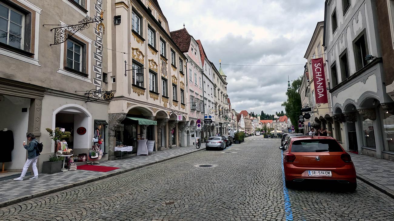
Adjoining the Stadtplatz to the north, the smaller Greenmarket (Grünmarkt) was once the medieval produce market and remains one of the most atmospheric corners of the old town, with painted facades, narrow lanes, and small open courtyards leading toward the river. Beyond the Greenmarket, steep cobbled lanes climb away from the centre toward the upper part of the city, with overhanging arches, hidden stairways, and small squares appearing at unexpected turns. On the opposite bank of the Steyr River, the Steyrdorf district preserves a quieter, more residential side of the historic core, with painted house fronts, traditional ironworkers' workshops, and the medieval Bürgerspital at Michaelerplatz, dating back to the early fourteenth century. Together, these areas reward an unhurried wander away from the busier main square.
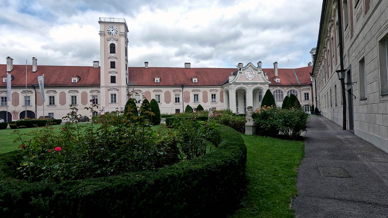
Lamberg Castle Above the Confluence
Looking down on the meeting of the rivers from a high terrace stands Lamberg Castle (Schloss Lamberg), the historic seat of power that gave Steyr both its name and its earliest history. The original castle was built here by the Otakar dukes around the year 980 and is first recorded in writing in 985, when it appears as Stirapurhc in the Mondsee documents. From this fortress the wider region took the name Styria, even though the modern Austrian province of that name lies further to the south. The castle passed in 1192 to the Babenbergs and later to the Habsburgs, and after a devastating fire in 1727 it was rebuilt as the Baroque palace standing today, in a graceful pale-pink ensemble of gabled wings around an inner courtyard. The castle's private library still contains over 11,000 books, some of them nearly five centuries old, and several rooms are used through the year for classical concerts and cultural events. A footpath through the small castle park, lined with old trees and ornamental statues, links the upper terrace to the old town below.
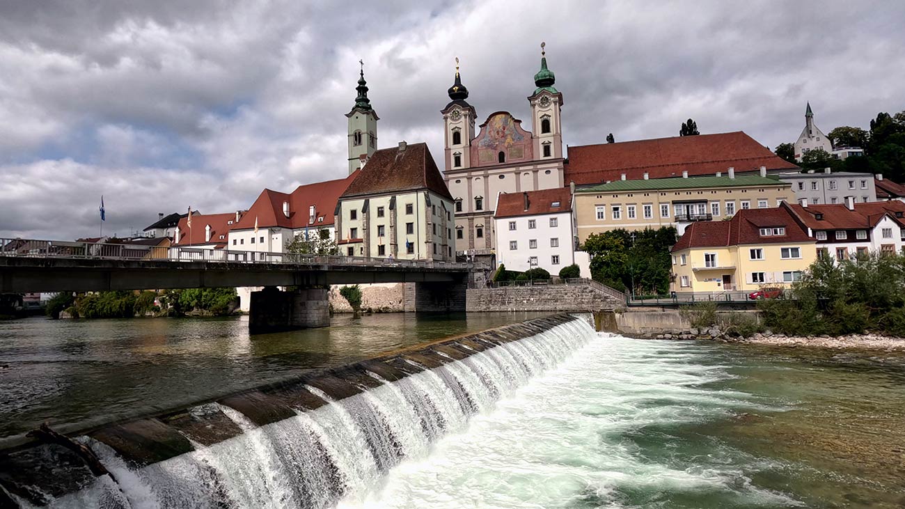
St Michael's Church at the End of the Bridge
At the lower end of the bridge that crosses the Steyr River, the twin towers of St Michael's Church (Michaelerkirche) rise above the rooftops in one of the most distinctive silhouettes in the city. The church was built between 1635 and 1677 as a Jesuit foundation, with its towers later raised between 1766 and 1770 to give the building its current proportions. The exterior is restrained, but the upper gable carries a dramatic fresco of the Archangel Michael casting down the fallen angels, and the interior opens into a richly decorated Rococo space with finely worked stucco, side chapels, and a high altar painting of Michael triumphing over Lucifer. The church served as a Jesuit college until the order's suppression in 1773 and became a parish church in 1785 under the reforms of Emperor Joseph II. Standing at the meeting of the two rivers, with the water rushing past its foundations, it remains one of the most quietly memorable Baroque interiors in Upper Austria.
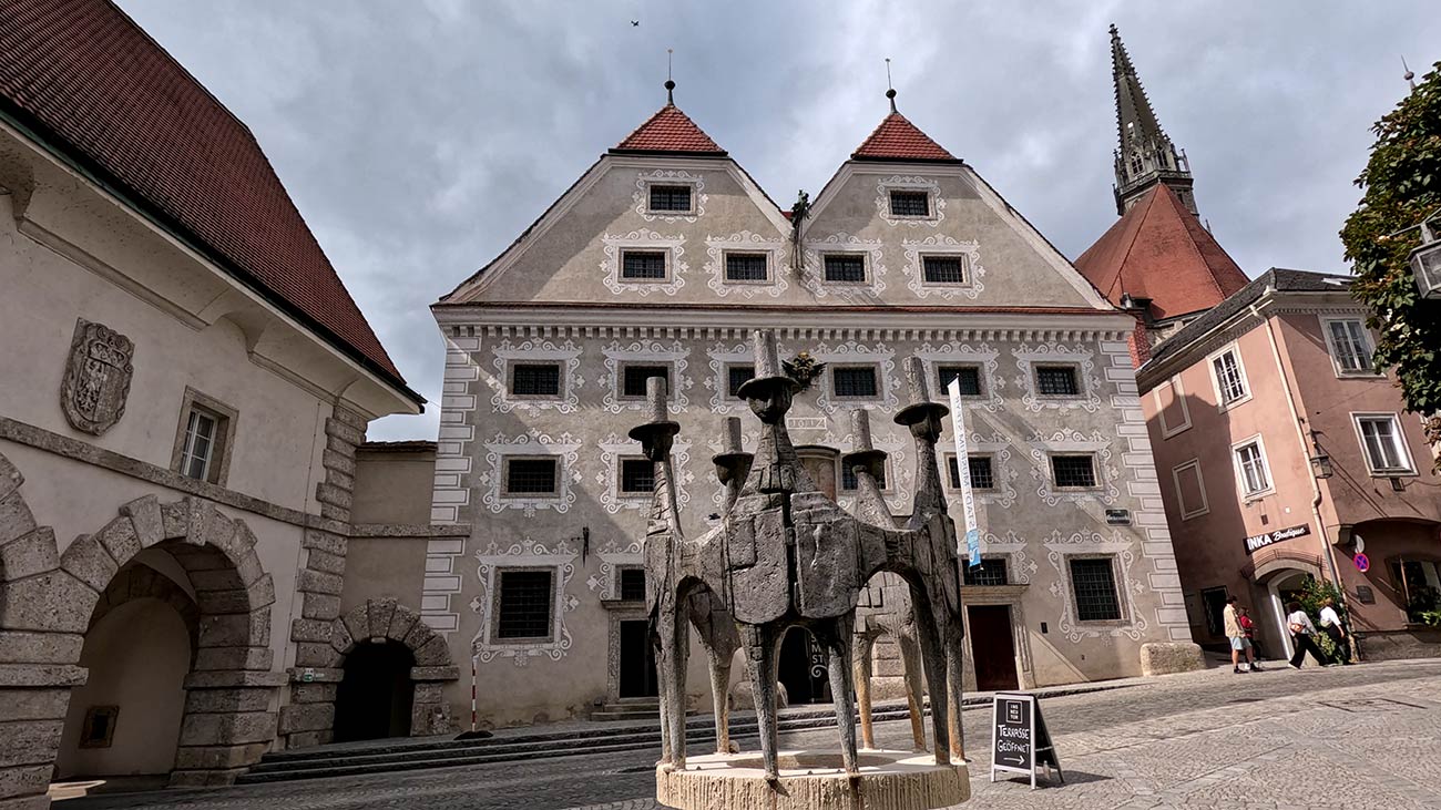
The City Museum, the Citizens' Fountain, and the Museum of Working Life
Steyr's long history is gathered under one roof at the City Museum (Stadtmuseum Steyr), set inside the Innerberger Stadel, a Renaissance double-gabled granary from around 1612 with an elaborate sgraffito facade at the northern end of the Greenmarket. Inside, the museum traces over a thousand years of city history, with a focus on nineteenth-century civic life and a multimedia exhibition on the composer Anton Bruckner. In the small square directly in front stands the Citizens' Fountain (Bürgerbrunnen), a modern sculpture created between 1977 and 1979 by the Linz sculptor Maximilian Stockenhuber as a symbol of the shared identity of the people of Steyr. A short walk along the river leads to the Museum of Working Life (Museum Arbeitswelt), set in a converted factory and dedicated to Steyr's long industrial heritage, from the medieval iron trade to modern Austrian names such as BMW Motors, Steyr Automotive, and the famous Steyr tractors.
 Useful Links
Mobility for Cyclists
Reaching the area by train with your bike
Steyr can be reached from the EuroVelo 6 by a single direct rail journey from one of the main cities on the Danube cycle path. The town lies around 30 kilometres south of the Danube in the Alpine foothills of Upper Austria, on a frequent regional line operated by ÖBB, the Austrian Federal Railways, which makes the connection both quick and well served throughout the day.
The connection
The most practical connection from the EuroVelo 6 corridor is from Linz, where regional and S-Bahn services run directly to Steyr in around 40 minutes, with hourly departures throughout the day and around 40 direct trains per day in total. The line runs south through the open countryside of Upper Austria, passing rolling farmland, small lakes, and views toward the limestone ridges of the Kalkalpen on the horizon. An equally convenient option is to board the same line at Enns, one of the oldest cities in Austria and itself a popular detour from the Danube cycle path, which lies halfway between Linz and Steyr with a journey time of around 25 minutes. Cyclists riding the Danube stretch of the route will find both Linz and Enns natural transfer points, and either journey fits comfortably into a single travel day with plenty of time to explore the old town on arrival.
Austrian trains
The rail network in Austria is operated mainly by ÖBB (Österreichische Bundesbahnen), the Austrian Federal Railways, which runs most long-distance services and a large share of regional connections across the country. Alongside ÖBB, the private operator Westbahn provides competing long-distance services on the main east-west corridor between Vienna, Salzburg, and onward to Munich. Several smaller regional operators run local and feeder lines on secondary routes, but they are fully integrated into the national rail system, so transfers between operators are straightforward. The Danube region in Austria is particularly well served by rail: the main east-west line links Vienna with Krems, Linz, Wels, Salzburg, and the German border at Passau, closely paralleling the river for much of its length and forming one of the busiest and most reliable rail axes in central Europe. From the main cities along this corridor, dense networks of regional and S-Bahn lines branch out both north and south of the Danube, with frequent departures throughout the day that make inland detours easy to organise without long waiting times or complicated changes. The ÖBB app is the central tool for planning journeys, checking timetables, and purchasing tickets across all services, including both regional and long-distance trains.
Taking your bike
Austria is generally very bike-friendly when it comes to rail transport, especially on regional services operated by ÖBB, which form the core of mobility for cycle touring along the Danube and its connecting corridors. On regional and S-Bahn trains, bicycles can be taken on board for an additional fee, with no advance reservation possible and a first-come, first-served allocation of space. Bicycle tickets are sold as single trips or as affordable daily, weekly, or monthly passes, and the Klimaticket Austria annual pass includes free bicycle transport on regional trains in several federal states. On long-distance services such as Railjet, Intercity, Eurocity, and Nightjet trains, an advance reservation for the bicycle is mandatory, with the bike zones located in second-class carriages. The private operator Westbahn, which runs frequent services along the main east-west corridor between Vienna, Linz, and Salzburg, also accepts bicycles, but only with an advance reservation. Folding bikes are carried free of charge as hand luggage on both ÖBB and Westbahn trains. Overall, the Austrian system is well adapted to cycle tourism and offers a flexible combination of train and bike that makes it easy to leave the EuroVelo 6 route in either direction for short or extended detours.
Bikes on Buses
Long-distance bus services in Austria are primarily operated by FlixBus and by ÖBB-Postbus, the long-distance coach arm of the Austrian Federal Railways, complemented by a smaller number of regional and private coach operators on selected routes. The long-distance bus market in Austria is less developed than in neighbouring countries, as the wider rail network covers most of the country efficiently and many connections that would otherwise be served by intercity coaches are instead handled by train. Bicycle transport is available on certain FlixBus connections, either via external bike racks or in the luggage compartment, but it is not consistently guaranteed across the network and depends on the specific vehicle type and route configuration. Where available, bicycle transport must be reserved in advance and capacity is limited, making it less flexible compared to rail services. ÖBB-Postbus also operates seasonal bicycle and hiking buses in cooperation with regional tourism boards, designed specifically to bring cyclists and hikers to popular starting points along trails and bike paths, although these services run on selected routes only and outside the main long-distance network. As a result, buses are generally used as a secondary option for cyclists, mainly for longer-distance repositioning between major cities rather than as a core part of cycling itineraries along the Danube region. While useful in specific cases where rail connections are less convenient, they are less predictable and less standardised for bicycle transport, so advance planning is essential.
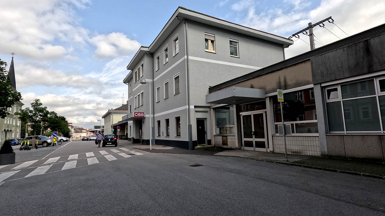
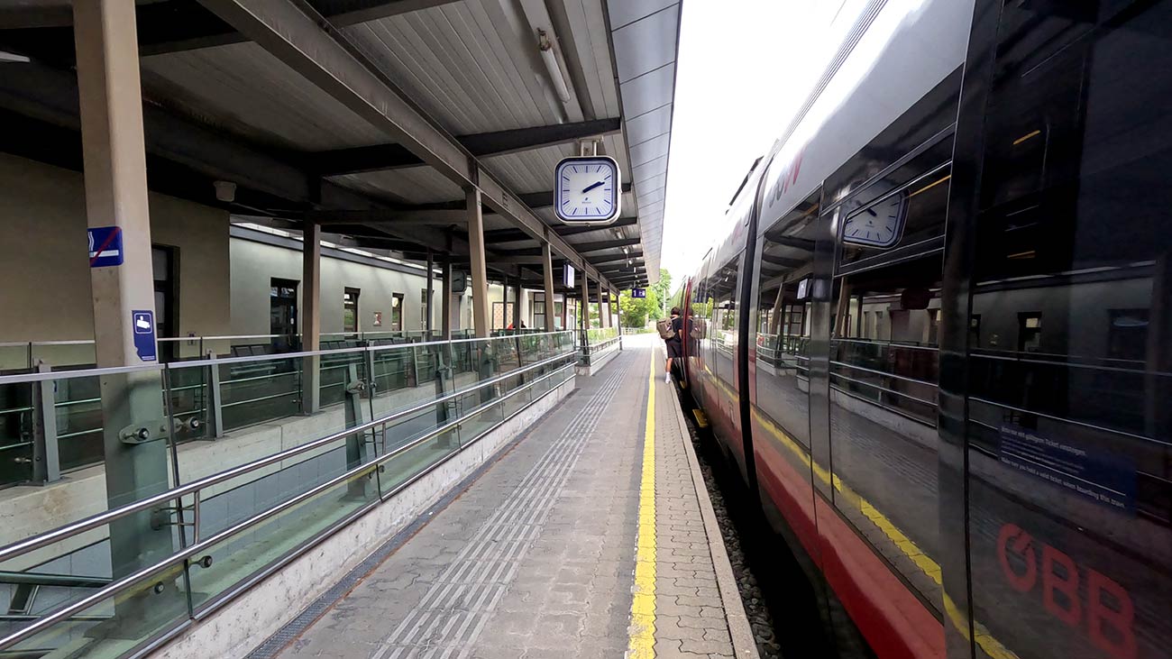
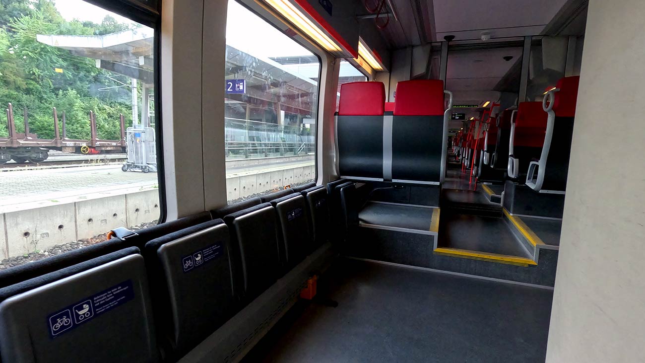
Arriving at Steyr Station
Steyr's main railway station sits a short ride from the old town, with the Town Square, the Greenmarket, the river confluence, and the foot of Lamberg Castle all reachable on foot or by bike in under fifteen minutes along largely flat, well-signposted streets. The historic centre is mostly pedestrianised and very compact, so most travellers leave their bicycles at their accommodation or at the station and explore on foot. The climb up to Lamberg Castle is easy via either the cobbled lane that winds up beside the Bummerlhaus or the small footpath through the castle park. Bike racks are available at the station for shorter stops. For onward travel, the same ÖBB line connects back toward Linz and the wider Danube region, so Steyr works equally well as a one-day excursion or as an overnight detour from the EuroVelo 6.